Written by
Aljan Scholtens
on
11 June 2024
From tech-savvy individuals to office workers and everyone in between; anyone can create a map with Wolf Maps. The best part? Filling your map with hotspots. That can, of course, be done manually – because those spots are still undiscovered. But now you can also use a (touristic) database in Wolf Maps: Plaece, from Insiders (also known as Open Data Platform - ODP). It lets you fill your map super fast with existing locations, content, and routes. And all the other benefits? We share them with you in this blog.
Open data?
In an earlier blog we already delved into the phenomenon of open data. Because 100% open data is the future. From the world, for the world. It’s up to you to give that information a place on the map.
Adding hotspots even more easily
The integration with Plaece has been a long-held wish, and with it we are taking another step forward. Not only for us but also for our users. Together with Marketing Drenthe, City Marketing Assen, Merk Fryslân, and Marketing Groningen, we have taken the first steps in integrating with Plaece. Let’s truly make open data work for unique cases: currently in Northern Netherlands, soon everywhere.
Thanks to the integration, you no longer have to add (existing) locations manually; you can simply import them into your map with one (or maybe two) clicks. It saves double work, and the information you add remains up-to-date. The control is managed by data specialists, so you can now focus on what really matters: reaching as many people as possible with your interactive map.
How do you use Plaece in Wolf Maps?
Is it really that simple? Absolutely. Open data is magical. So far, we have several cases in Drenthe where Plaece is used, but more on that later. First, a brief explanation.
Want to retrieve data from Plaece? Then you can immediately see, through the gray dots, which destinations and locations you can add directly. Zoom in, choose the location you want to add, click, and that’s it. With just a blink of your eyes, a new spot is added to your map. Complete with description, image, and any audio clips.
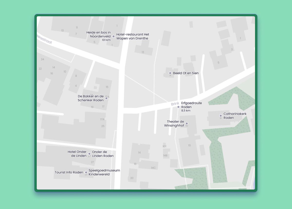 Locations from Plaece visible as gray dots
In addition to locations, you can also add other types of data, such as cycling and walking routes. Within a few minutes, you’ll have a well-populated map with essential spots that you can, of course, continue to expand with your own unique locations and valuable input.
Your map, your unique touch
If you use Plaece, descriptions, images, and other information are directly imported from the existing platform, provided and maintained by others. But we understand if you want to maintain your own tone of voice or share unique stories and photography that better suit your target audience. That’s why (even after importing a location from Plaece) you can modify that location on your map. You can overwrite all fields with your own information: the description, image, and audio clips.
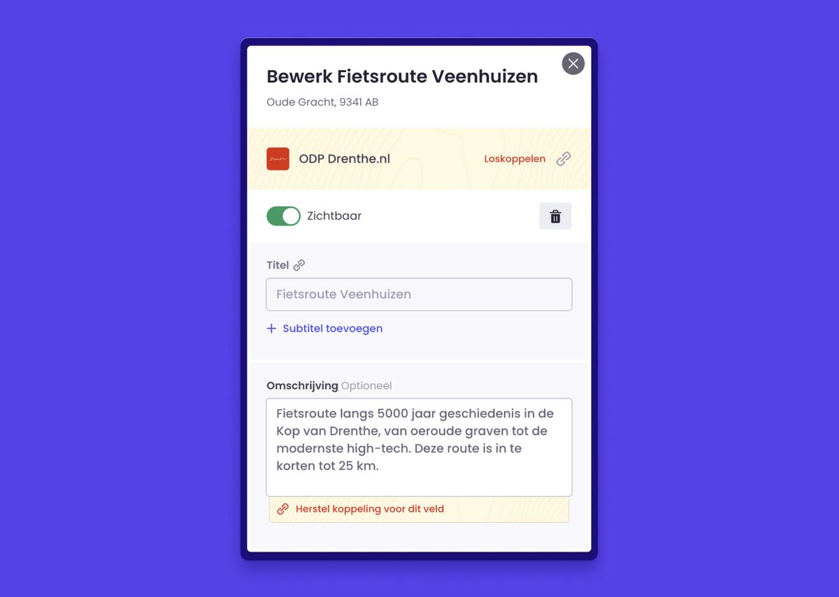 Easily adjust the location to your preferences
That only means there is no longer a direct link with Plaece, and you must keep the location up-to-date yourself. Of course, you can easily restore the integration later. You can switch between your own unique input and using the existing data. Prefer to import everything directly from Plaece? That’s also possible! You remain in control.
The first case with Plaece
Of course, we were already proud of our beautiful province. Part of our team has their home base here. But we’ve also had the opportunity to facilitate some great maps: for Assen, Verhalenweekend Drenthe, Nationaal Park Drentsche Aa, Gemeente Aa en Hunze, Emmen, and more. All with a focus on culture, recreation, nature, and history in Drenthe.
The integration with Plaece emerged from a joint initiative of several municipalities in Drenthe and tourism providers. After Gemeente Aa en Hunze went live with their interactive map, other municipalities and foundations quickly followed. We then sought the right connection between these maps. That’s why every map now uses the same Drenthe style and a shared database. The next step? Even better and more efficient collaboration without unnecessary double work. And behold, the integration with Plaece.
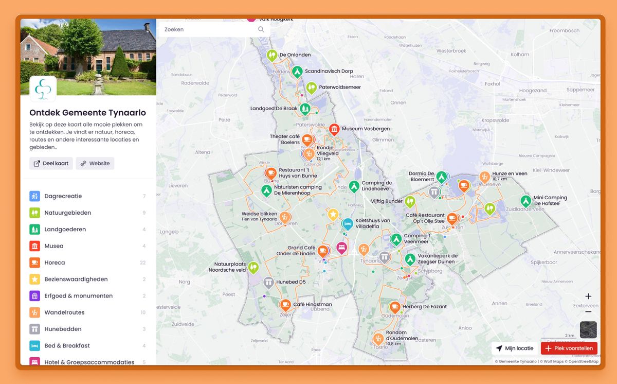 Municipality Tynaarlo and Wolf Maps
Entrepreneurs, municipalities, and foundations can make adjustments in Plaece faster for even more up-to-date information about locations. Moreover, maps can be linked together so that visitors can navigate even better between destination A and B and enjoy Drenthe without limits. And who knows, this integration might even cross provincial or national borders in the future. Whatever happens, it can be found in Wolf Maps.
Want to see how it works? Then watch the explanatory video.

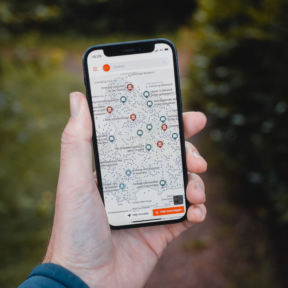
 Locations from Plaece visible as gray dots
 Easily adjust the location to your preferences
 Municipality Tynaarlo and Wolf Maps