Public Space & Participation

Wolf Maps

Maps are our guides for connection and engagement. Maps that clearly display changes and plans and invite citizens to participate together. Together and accessible.

Citizen Participation and Environmental Management

The most progressive plans require a connector. Someone or something that sees where opportunities lie, mindful of each other’s needs, similarities, and desires. Whether it’s about creating a better living environment, mapping changes, or gathering input for impactful projects.

In our interactive map, plans and people come together as we collaboratively build a better place for everyone. In this way, municipalities and developers can work together with local residents (citizen participation) to merge creative and innovative ideas and transform them into a safe, vibrant, future-proof, and sustainable environment.

Our map is the facilitator. It enables you to share information about important changes in the region, garnering more support and understanding. For optimal environmental management. After all, a map often speaks louder than a thousand words. Would you like to experience it for yourself?

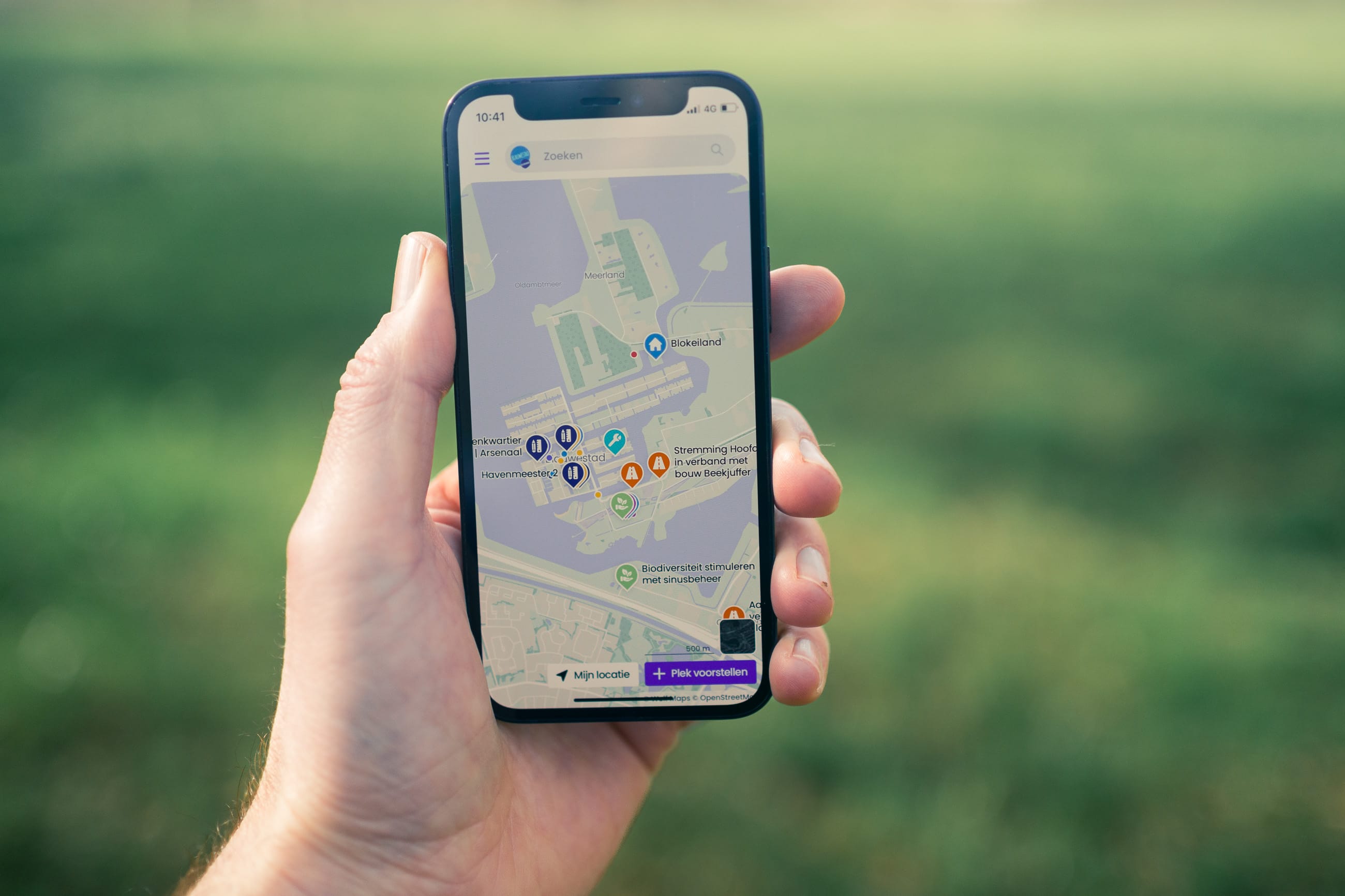
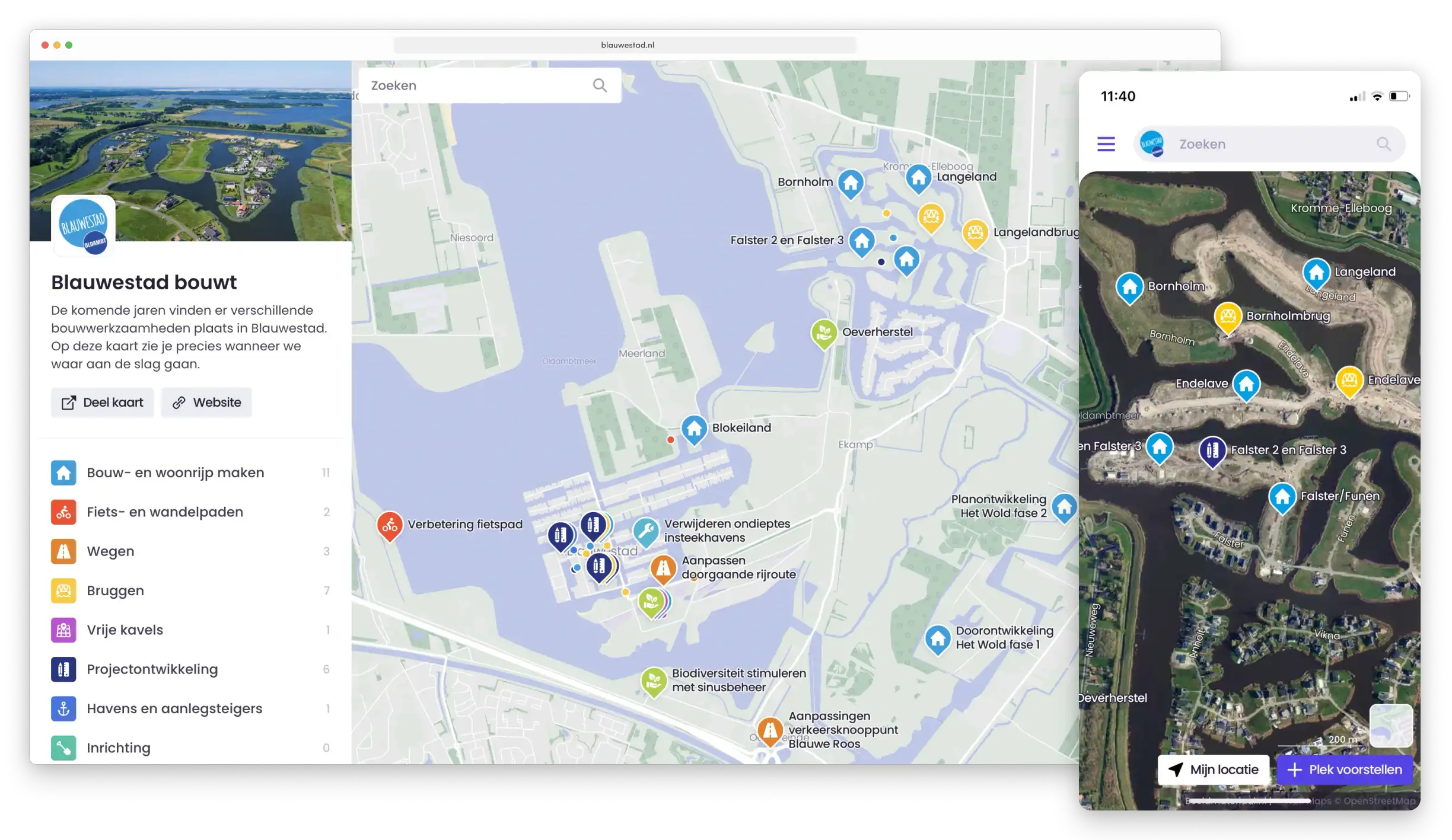
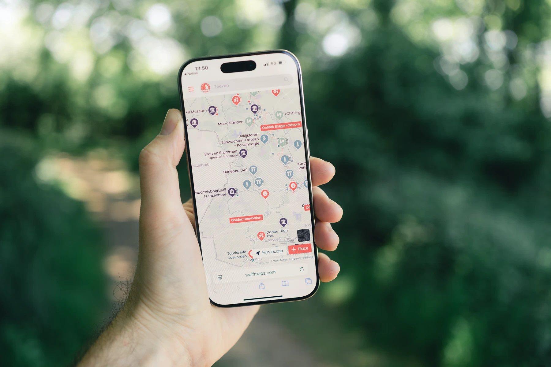
Screenshot Wolf Maps

Map makers

I'm empty?

Eefje Koning
Eefje Koning Bureau Meerstad

"Bureau Meerstad was looking for a good solution to display activities and facilities in a clear manner. We found this solution with Wolf Maps. The Wolf Maps map is clear, organized, and easy to use. The guidance is pleasant, responses are prompt, and there is collaborative thinking. We are satisfied!"

Blauwestad bouwt

Blauwestad bouwt

De komende jaren vinden er verschillende bouwwerkzaamheden plaats in Blauwestad. Op deze kaart zie je precies wanneer we waar aan de slag gaan.

View map

Fenna de Vries
Fenna de Vries Vonc Communication

"We used Wolf Maps during a participation process with the residents of a municipality. The interactive map with potential locations for an asylum center was easy to use both during a residents' meeting and from the comfort of home. During the meeting itself, it was a valuable tool to initiate dialogue. In short, a valuable tool during a participation process."

Mirjam Pijning
Mirjam Pijning Blauwestad

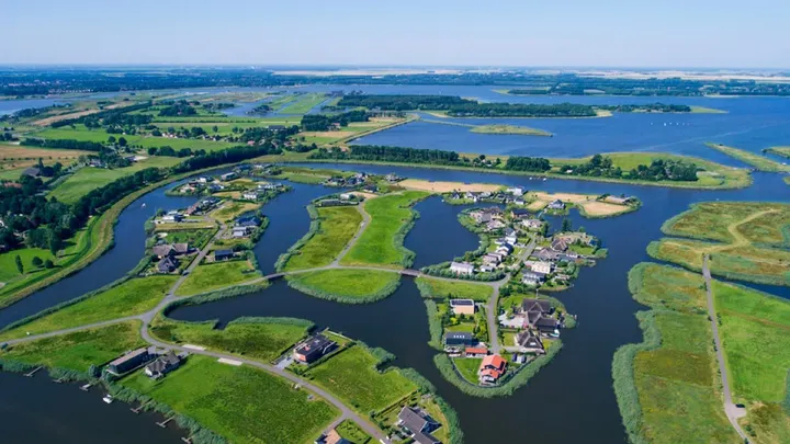
"The beauty of Wolf Maps is that it includes very high-quality satellite images that renew every year. What I find very strong is that it just looks very appealing."

Meerstad en omgeving

Meerstad en omgeving

Welkom op de interactieve kaart van Meerstad en omgeving. De kaart geeft je een overzicht van (toekomstige) werkzaamheden en voorzieningen. Het is mogelijk dat niet alle (toekomstige) werkzaamheden en voorzieningen op de kaart staan, de kaart wordt regelmatig bijgewerkt.

View map

Logo Meerstad Logo Heerenveen Logo IVN Logo Blauwestad

More support and a better living environment

Fully online

Flyers delivered through mailboxes, letters, or entire newspapers might be read, but they are not kept for long. For major projects, our interactive map is the perfect solution. Always and everywhere accessible to everyone, even for those who are less digitally inclined or have difficulty reading. And there’s always room to add updates and new information yourself.

Participation

Wolf Maps brings together people, activities, and businesses at a glance. Did you know that citizens and other participants can easily and quickly suggest ideas for your map?

Take control yourself

You can effortlessly make changes to your Wolf Maps on your own, without help from us or an IT professional. This not only saves money on updates and maintenance but also ensures you retain full control over your own map. Our interactive map is already there. It’s just up to you to customize, adapt, and maintain it according to your needs.

Accessible online everywhere

Creating your first map today means you can immediately share it online everywhere. Embed it on your own website, share it via QR codes across different channels and media, on social media, or even as a standalone on your own (sub)domain. One map to use across all your communication channels. Incredibly efficient!

Visually stimulating and evokes curiosity

Taste is subjective, but our map boasts a fresh design and striking elements. This transforms a simple interactive map into a visually appealing tool for better usability and an enhanced experience for everyone.

Boundless possibilities

The interactive map from Wolf Maps is a powerful tool that fosters participation and creates impact. It is a bridge between the digital and real worlds and encourages people to take part, exactly what we aim to achieve. But there's more!

Ontdekken als kaartmaker met een interactieve kaart
Satellite images and aerial photos on the digital map

High-Quality Aerial Photos

Each year, an airplane flies over the Netherlands to capture beautiful aerial photos, updated annually in Wolf Maps. Ideal for visitors to orient themselves, these photos are also perfect for visualizing changes in an area, like land development.

Interactive map with routes

Routes That Bring Adventure

Add routes to your map, whether it’s a marathon or a hiking trail. Visitors can start the route from their location and follow every turn and kilometer. The perfect start for the next adventure.

Organize your map with categories

Organize with Categories

Make your map more manageable with categories. Colors and symbols help visitors quickly find what they’re looking for, whether it's ancient structures, hiking routes, or ongoing projects. Categories offer an intuitive way to filter and focus.

Rating of places

Rate Places

Allow visitors to rate places to map quality or collect feedback on new suggestions. Useful for knowing what’s truly worthwhile or what locations need to be added.

Automatic QR codes for your places and map

QR Codes

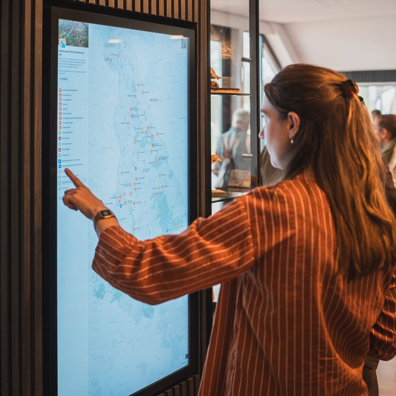
Make your interactive map and locations easily accessible offline with our handy QR codes. Place them on info boards, stickers, guides, or kiosks so visitors can scan the map and explore anytime, anywhere.

Custom branding on your interactive map

Custom Style and Branding

Give your map a personal touch with your own images, logo, and colors. This makes the map perfectly match your style and brand identity.

Outline your area

Focus with an Outline

Want to give your map more focus? Place an outline around your areas. Perfect for clearly defined locations like a city or national park. It shows exactly which area you're dealing with and brings more focus to your map.

Analytics

Analytics

Link your map with privacy-friendly analytics for detailed insights. View metrics like how many people use your map, how often your QR code is scanned, and discover which locations draw the most attention.

Video on the map

Enrich with Photo and Video

Add photos and videos to your locations to offer visitors more than just a map. Each image creates a richer experience, drawing them into the essence of the place for a deeper discovery beyond words alone.

Follow our discoveries

Hiking and cycling nodes on the map

Hiking and cycling nodes on the map

Read blog
This Was Our Very First Wolf Maps Event

This Was Our Very First Wolf Maps Event

Read blog

Backstage Newsletter

Would you like to stay updated on how Wolf Maps is developing? Sign up for our backstage newsletter.

Put your world on the map