
All features
Map Content
Structure & Sources
Platform & Organization
Map Content
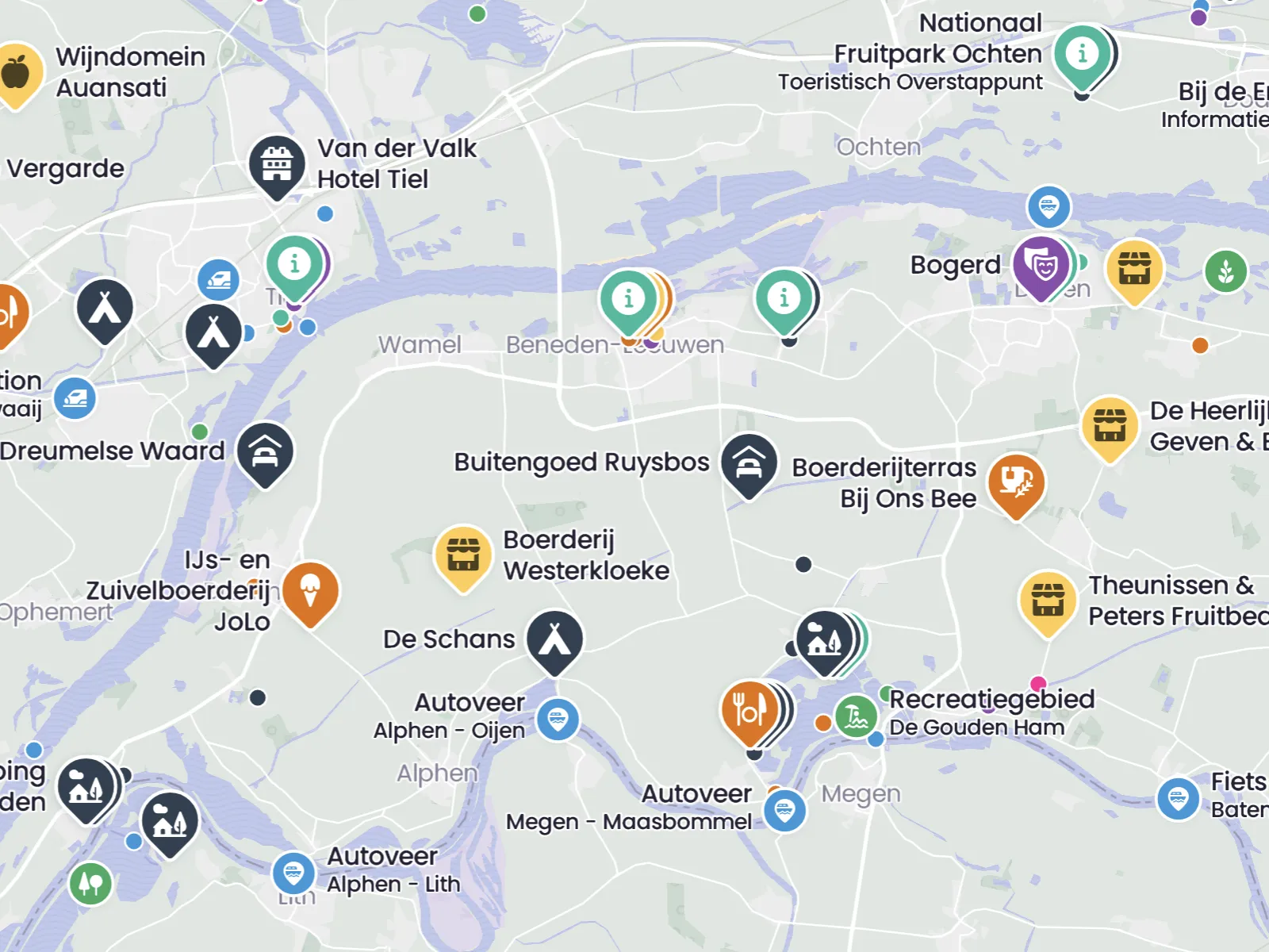
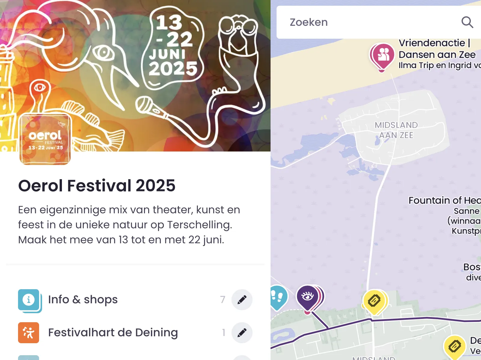
Places That Are Truly Yours
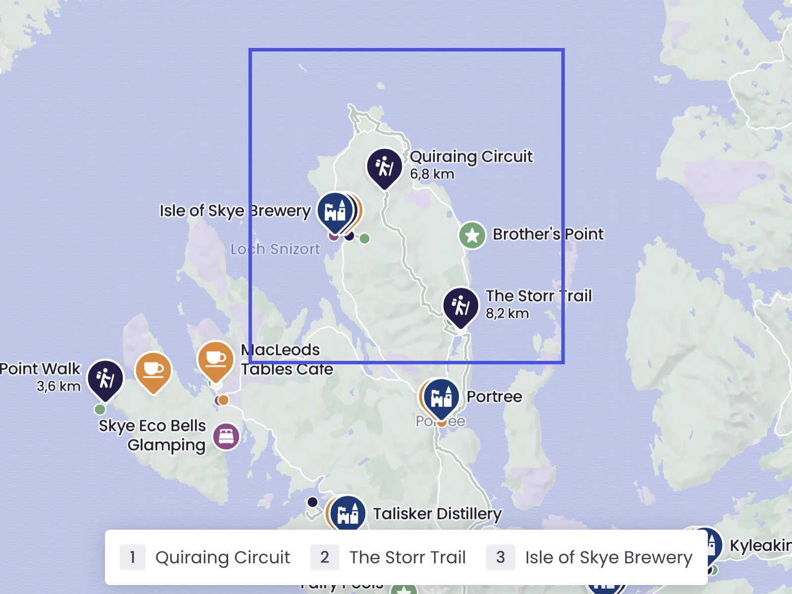
A good map starts with the right places. Add your own locations, decide what is visible, and choose between larger and smaller pins to give key places a little more attention. That way visitors immediately see where to go and what deserves a closer look.
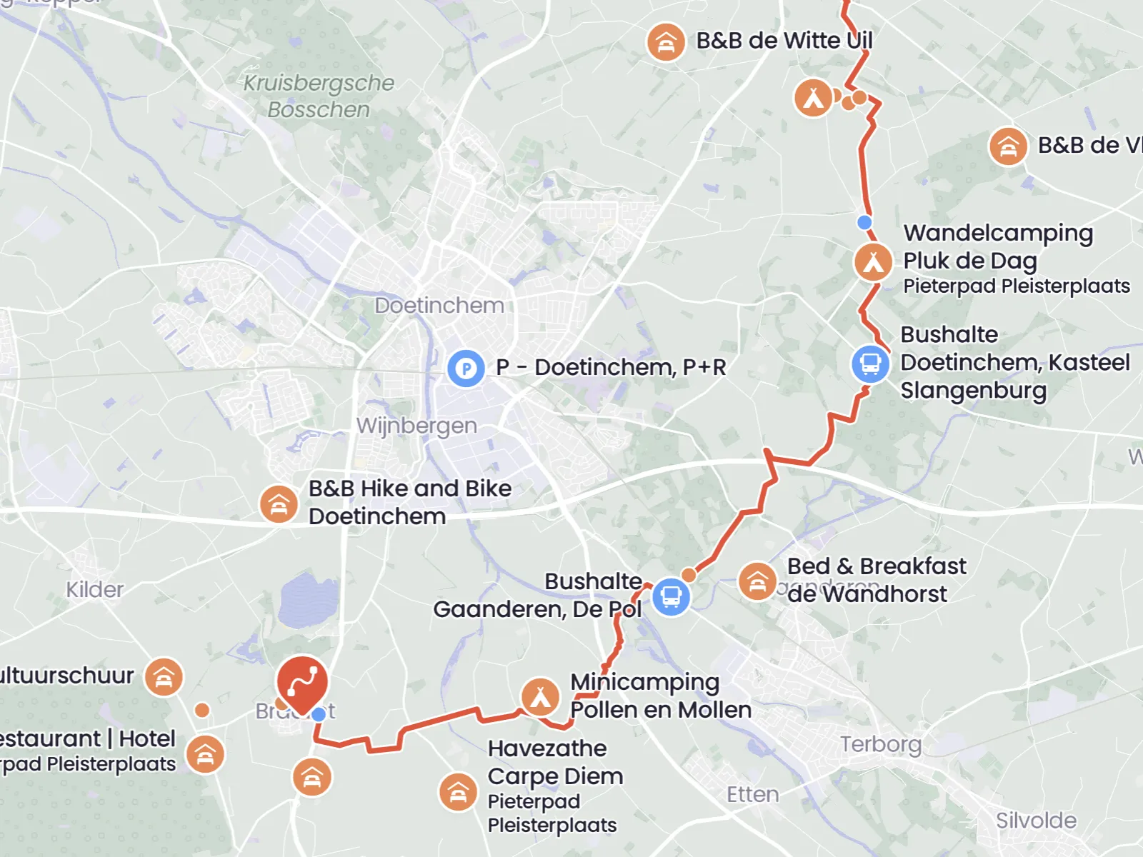
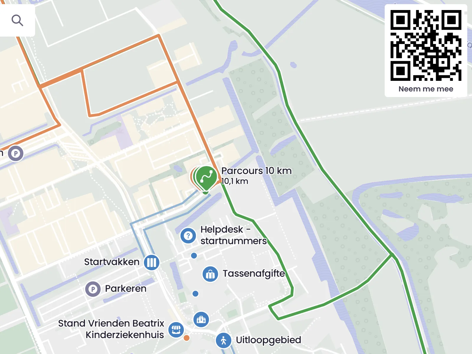
Routes That Invite People to Explore
Not every route needs the same visual weight. Add walking routes, cycling routes, or event routes, give your main route a thicker line, and show alternative routes more subtly. That helps visitors instantly see which route leads and which options branch off from it.
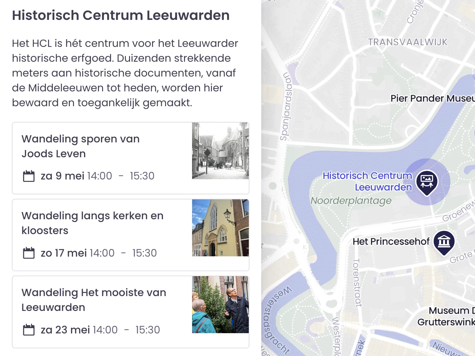
Events That Keep Your Map Current and Useful
Sometimes you want to show more than a fixed place. With events, you can give a location a specific date and time for an activity, performance, or program item. If you work with a venue or location that regularly hosts something, you can also load events into that venue so the agenda and map come together naturally. That makes this especially useful for festivals, cultural agendas, city guides, and locations with a changing program.
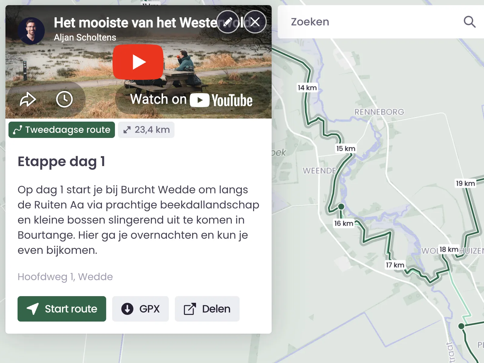
Photo and Video That Say More Than Text Alone
A map becomes much stronger when people can immediately see what a place feels like. With photos and video, visitors get context, atmosphere, and recognition before they even arrive. That makes it easier to choose, easier to understand, and much easier to feel curious about what is waiting there.
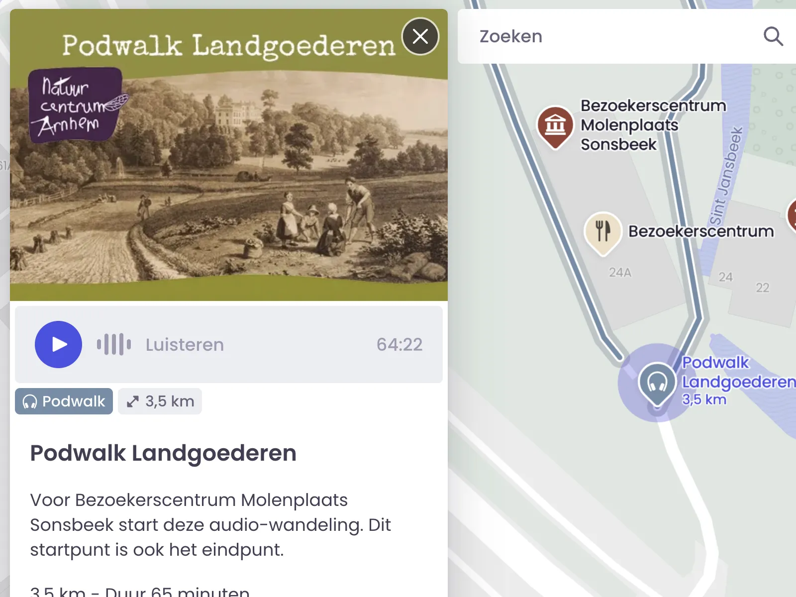
Audio for Maps That Need a Human Voice
Sometimes you do not want visitors to read. You want them to listen. With audio, you can add stories, explanations, and atmosphere exactly where they matter. That makes this feature especially useful for podwalks, audio tours, experience routes, and educational maps. It adds a more personal layer and often makes the map easier to use as well.
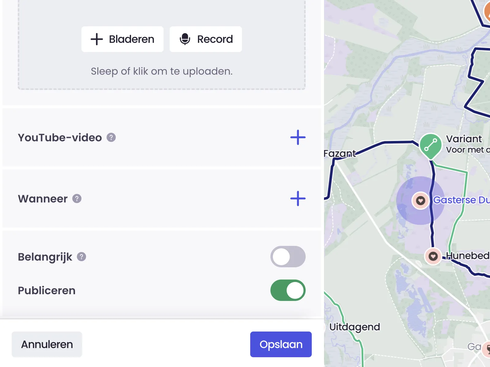
Visible When You Decide
Not everything needs to go live at once. Sometimes you are still building, sometimes information is temporary, and sometimes you simply want to test things first. With publishing controls, you decide which places, routes, and categories are already visible and which stay hidden a little longer. That keeps your map current, clear, and reliable while things are still changing behind the scenes.
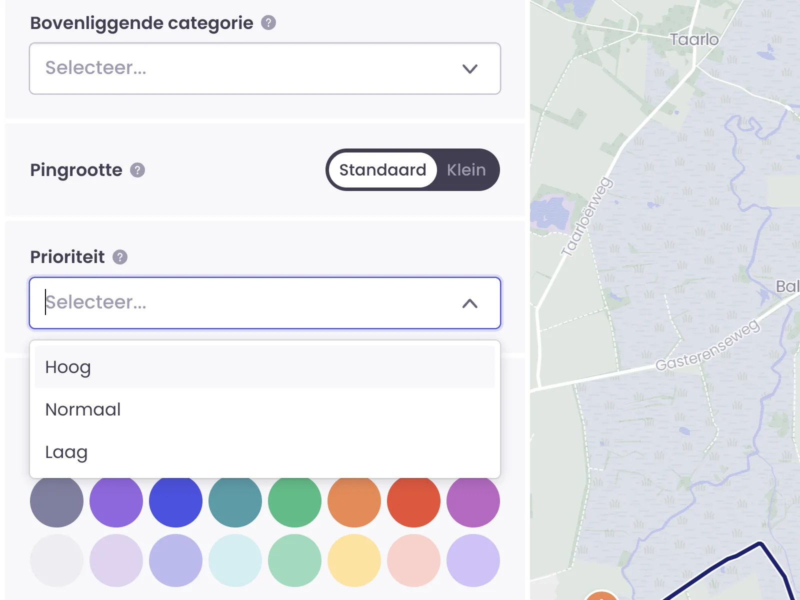
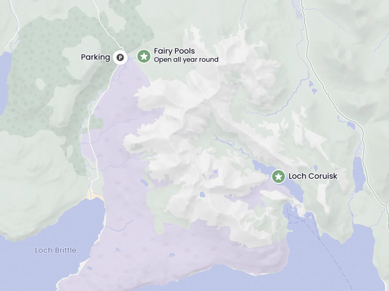
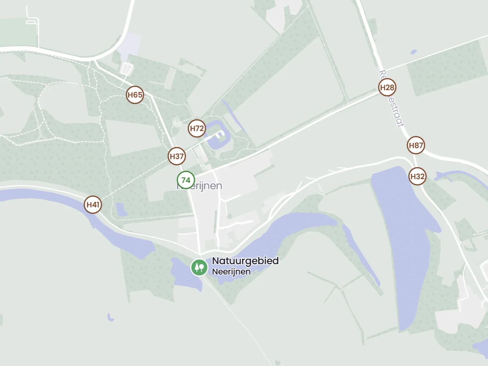
Give Important Places More Attention
Not every place matters equally. Sometimes you want a main location, starting point, or key destination to stand out a little more. With priority settings, you help visitors see where the focus should be, without making the map feel busy or forced.
See Your Own Location Right Away
As soon as visitors can see where they are, a map becomes much more practical. It helps them discover nearby places, follow routes, and keep their bearings in busy or unfamiliar areas. On mobile especially, this makes the difference between browsing and actually using the map.
Aerial Photos for Better Recognition
Sometimes a standard map is enough. Sometimes an aerial photo works better. Up-to-date aerial imagery gives visitors stronger visual recognition and helps them understand an area more quickly. It is useful for orientation, but also for maps that need to show change in landscape or public space.
Hillshades for Maps Where Relief Matters
Sometimes you do not only want to see where something is, but also how the landscape moves. Hillshades give height differences, slopes, and valleys much more depth. That makes your map stronger for nature areas, walking routes, and hilly terrain, and helps visitors understand an area more intuitively.
An Outline That Defines the Area Clearly
A clear boundary gives visitors immediate context. It shows which area is central to the map and prevents the experience from feeling too wide or undefined. For cities, parks, projects, and clearly marked zones, that extra focus makes the map easier to read and easier to trust.
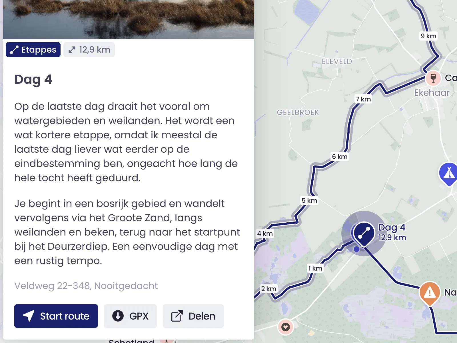
Start Route
A route becomes much more useful when people can start it directly and follow it as they go. With Start Route, the map moves with the visitor while walking or cycling. That makes it easier to stay oriented, keep moving, and trust the route while on location.
Junctions
Junctions give visitors more freedom to build their own route. By enabling walking or cycling junction networks, you add an extra navigation layer that works well for people who want to explore on their own terms instead of following one fixed route.
Structure & Sources
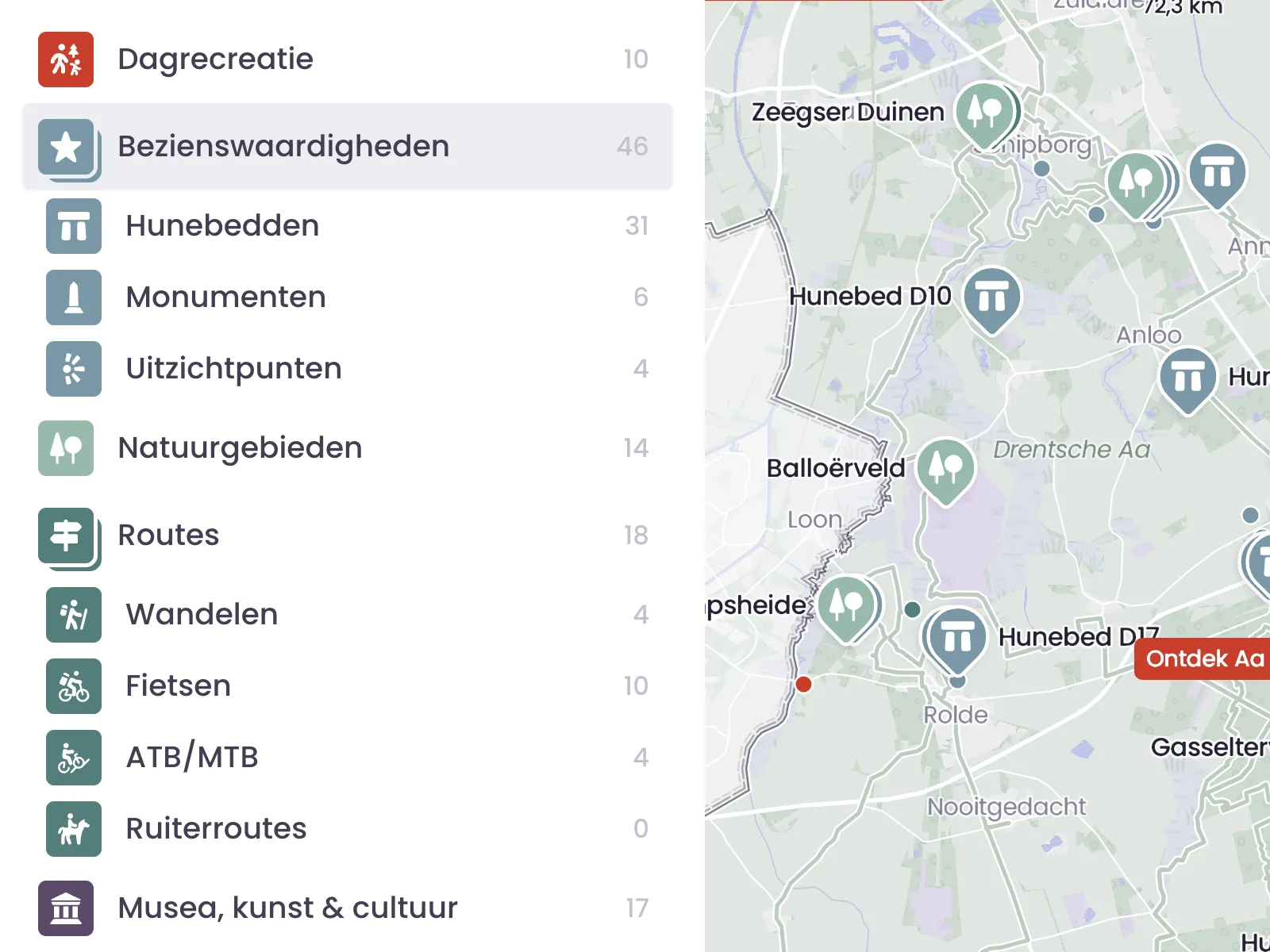
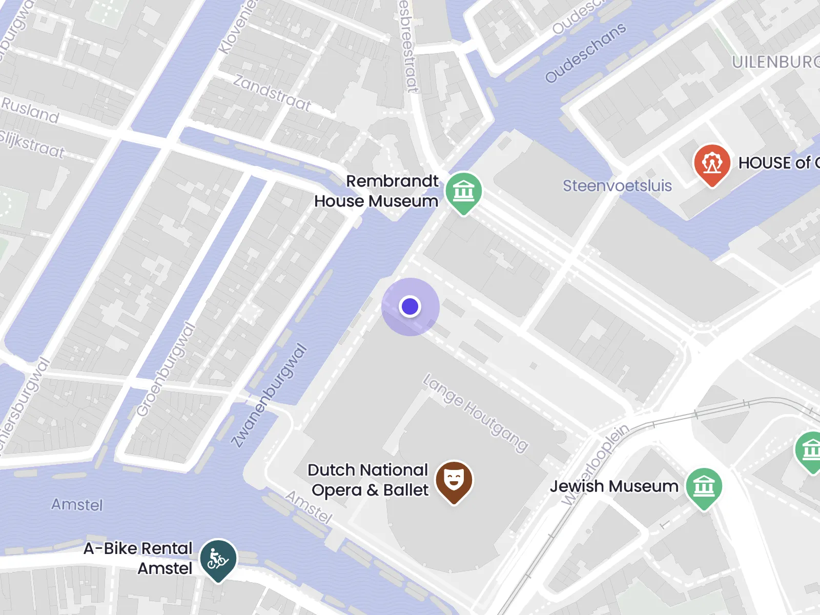
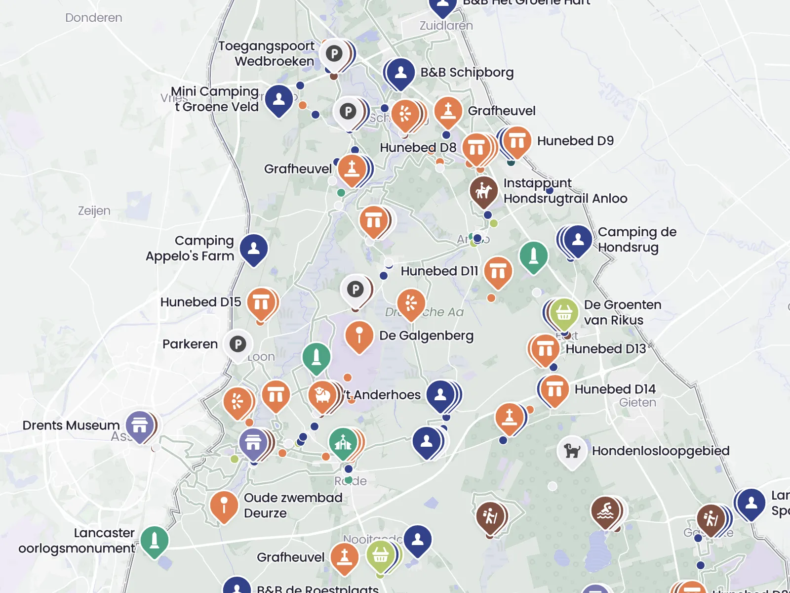
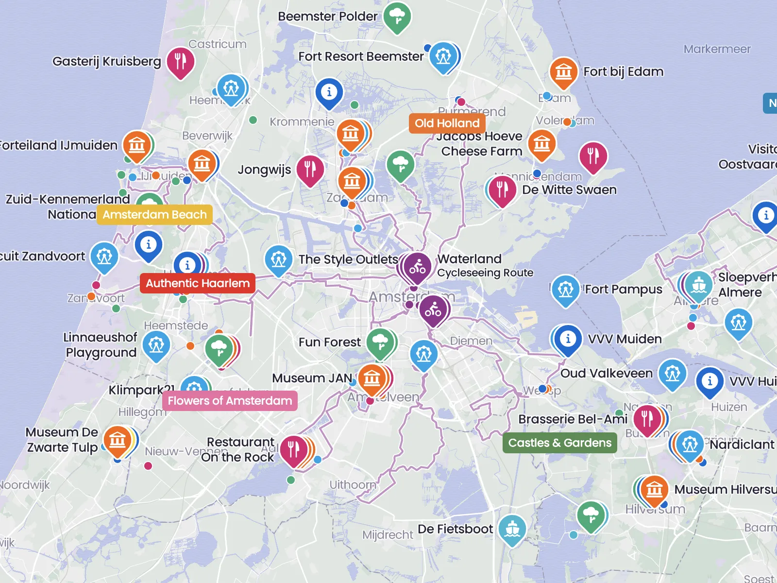
Categories That Bring Order to Your Map
Categories are the foundation of a clear map. They help you group places in a logical way and make it much easier for visitors to understand what belongs where. With the right structure, your map feels calmer, clearer, and easier to use.
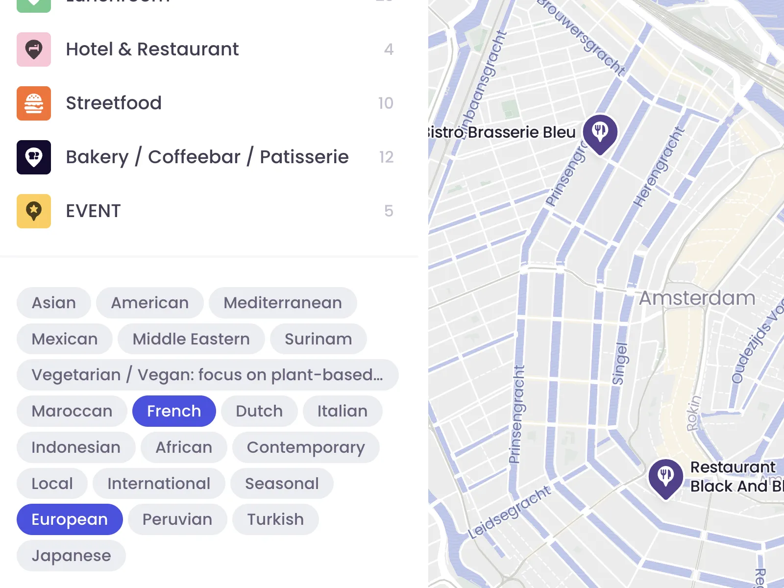
Tags for Extra Detail and Better Filtering
Where categories create structure, tags add nuance. They are useful for properties like family-friendly, wheelchair accessible, or free entry. That gives visitors a faster way to narrow things down and find places that actually fit what they need.
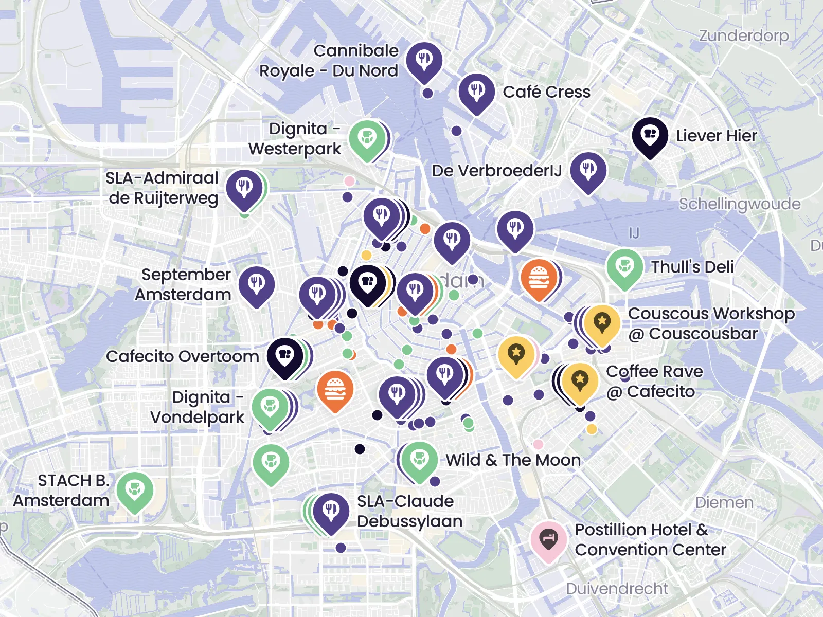
Clusters That Keep Things Readable
A map with lots of information does not have to become hard to read. Clusters group nearby places together when things get busy on screen. That keeps the map usable, makes zooming feel natural, and helps visitors keep their bearings while exploring.
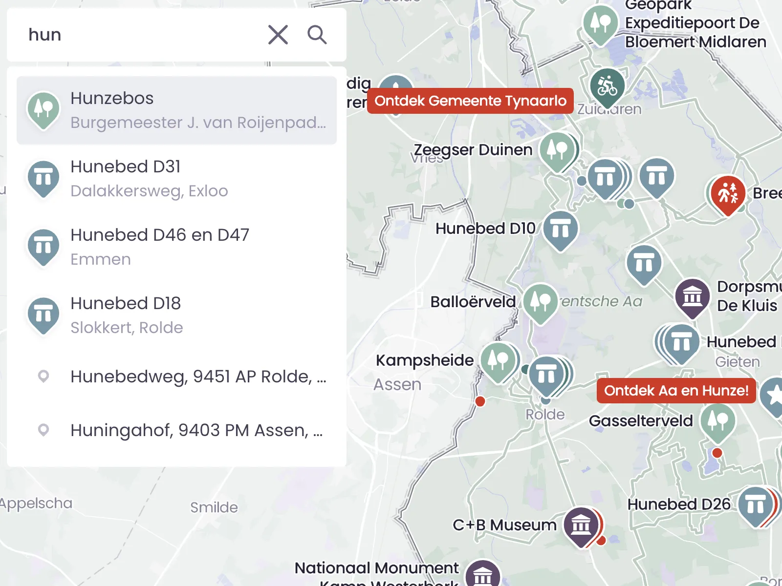
Search That Gets You There Faster
Not every visitor uses a map in the same way. Some like to browse. Others want to search immediately by address, name, or place. A strong search function supports both, making the map more practical from the first second.
Maps That Work Together Naturally
Sometimes one map is not enough. By linking maps together, visitors can move smoothly into a neighboring area, a deeper topic, or another layer of information. That keeps each map focused, while still making the full experience feel connected.
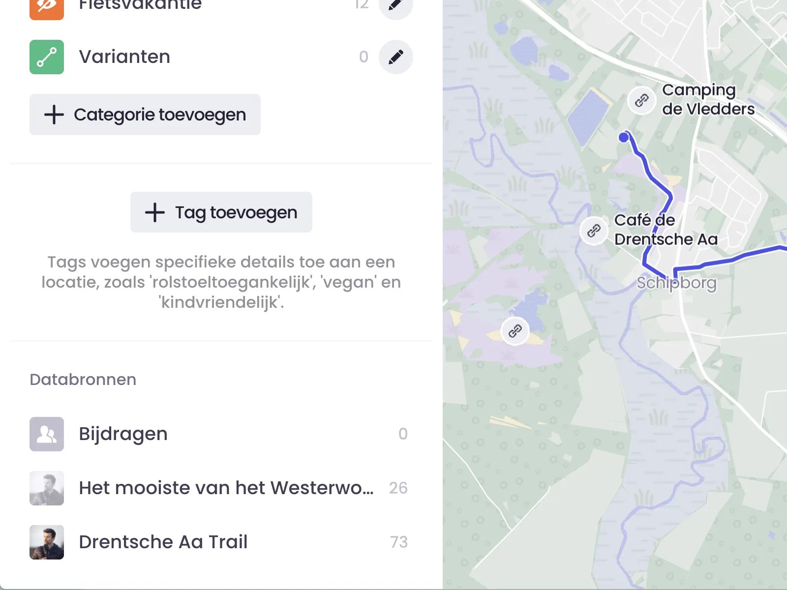
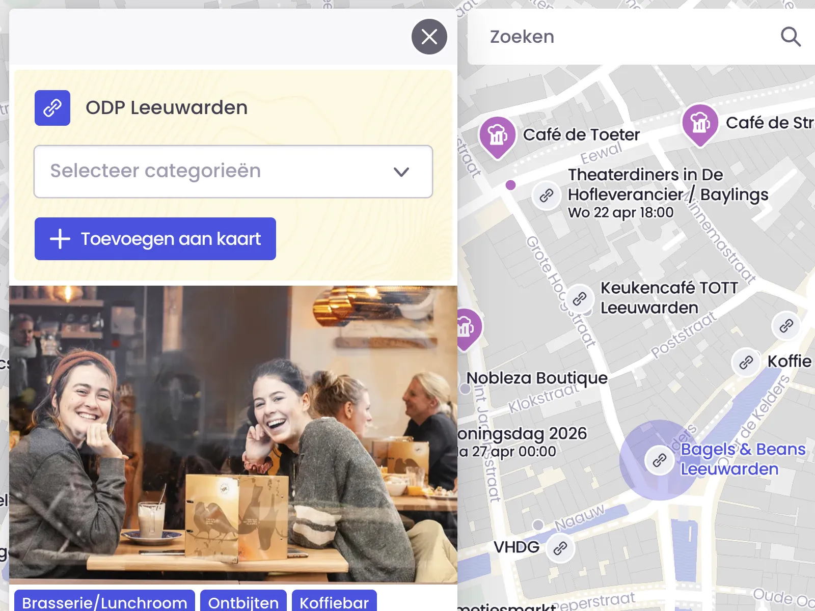
Use Another Map as Your Source
Sometimes you do not need to start from scratch. Use another Wolf Maps map as the source for a new map, switch it on while you build, and only add what is still missing. Places stay in sync automatically, and if you want, their categories can stay synced too.
Integrations That Keep Your Map Up to Date
If you already work with an external source or database, you do not want to manage everything twice. Integrations help you bring existing data into your map and keep it easier to maintain over time. That saves time, reduces mistakes, and makes updates much more manageable.
Sharing & Distribution
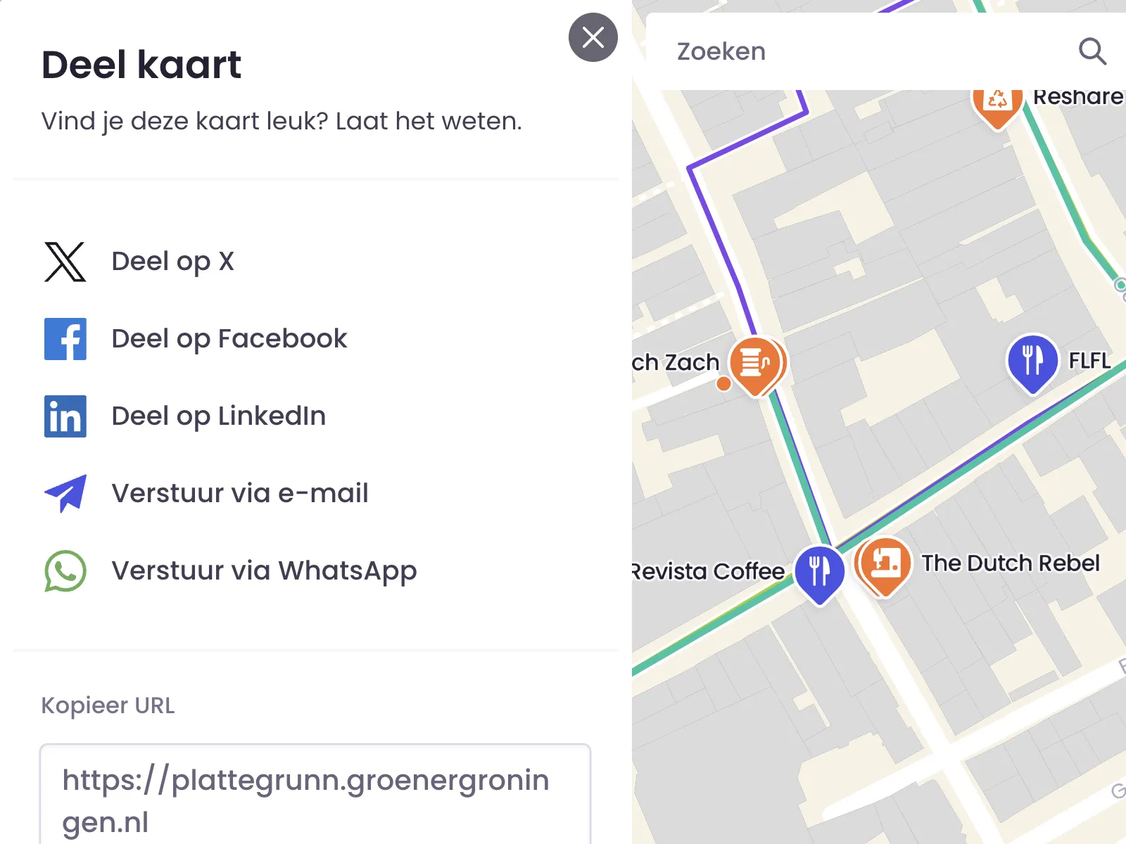
Share Quickly Through Social and Messages
A good map should be easy to share. Whether it is a specific place or the full map, you can send it out through social platforms, email, WhatsApp, or a direct link. That helps you spread reach quickly and point people to exactly the right place.
Embed It on Your Own Website
Your map does not need to live separately from your website. By embedding it, you place the interactive map directly on your own page, so visitors do not have to click away first. You can show the full map or a more focused view that fits the context of the page.
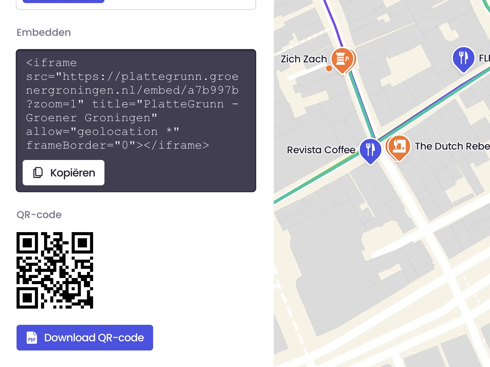
QR Codes for Real-World Use
QR codes connect the physical world to your digital map. Add them to signs, stickers, flyers, or visitor desks and let people scan straight into the right map or place. That makes the map far more useful in the moment, exactly where people need it.
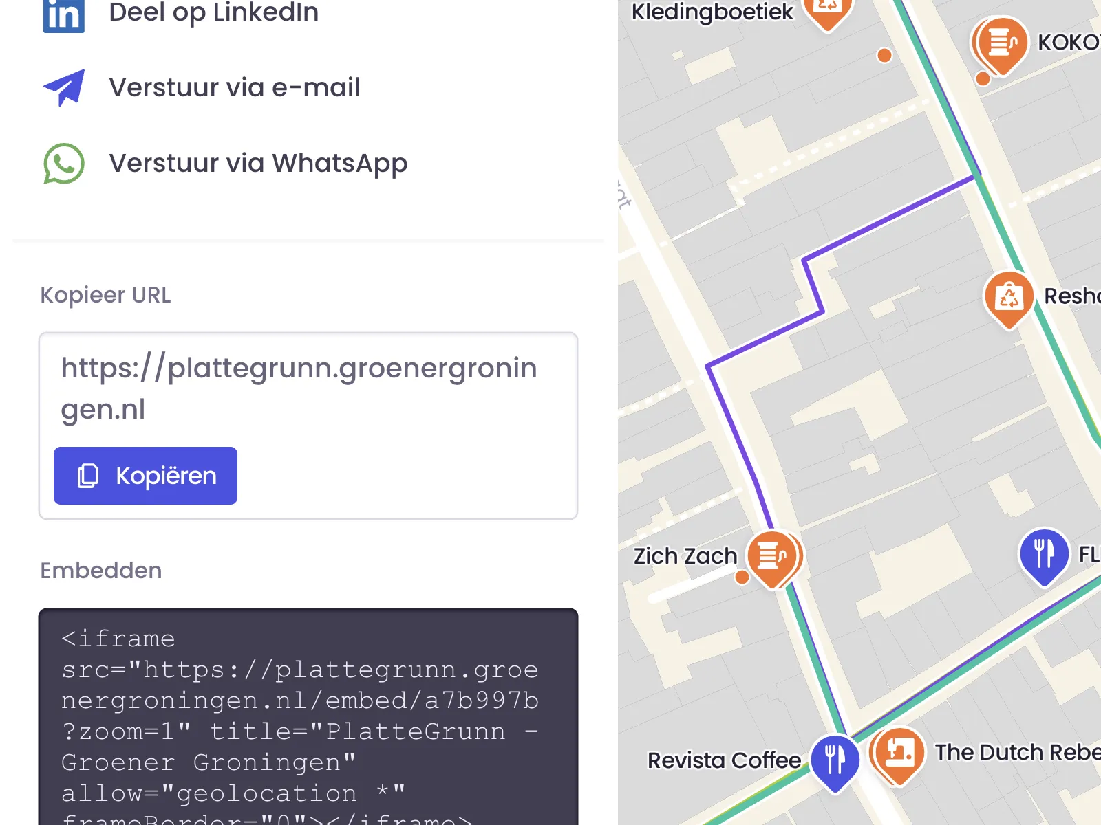
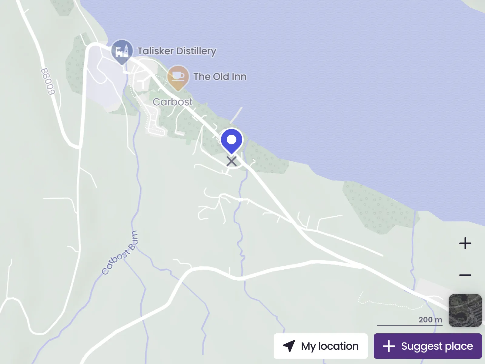
Share the Exact Link You Need
Sometimes you do not want to share the whole map, only the exact part that matters. By copying the URL, you can point to a specific place, category, or zoomed-in area. That is useful for campaigns, newsletters, support pages, and any context where precision matters.
Easy to Continue on Mobile
People often first see a map on a large screen, but use it later on their phone while moving around. This feature makes that handoff simple. Scan once, and the map comes with you, ready to use on location, outdoors, or along the route.
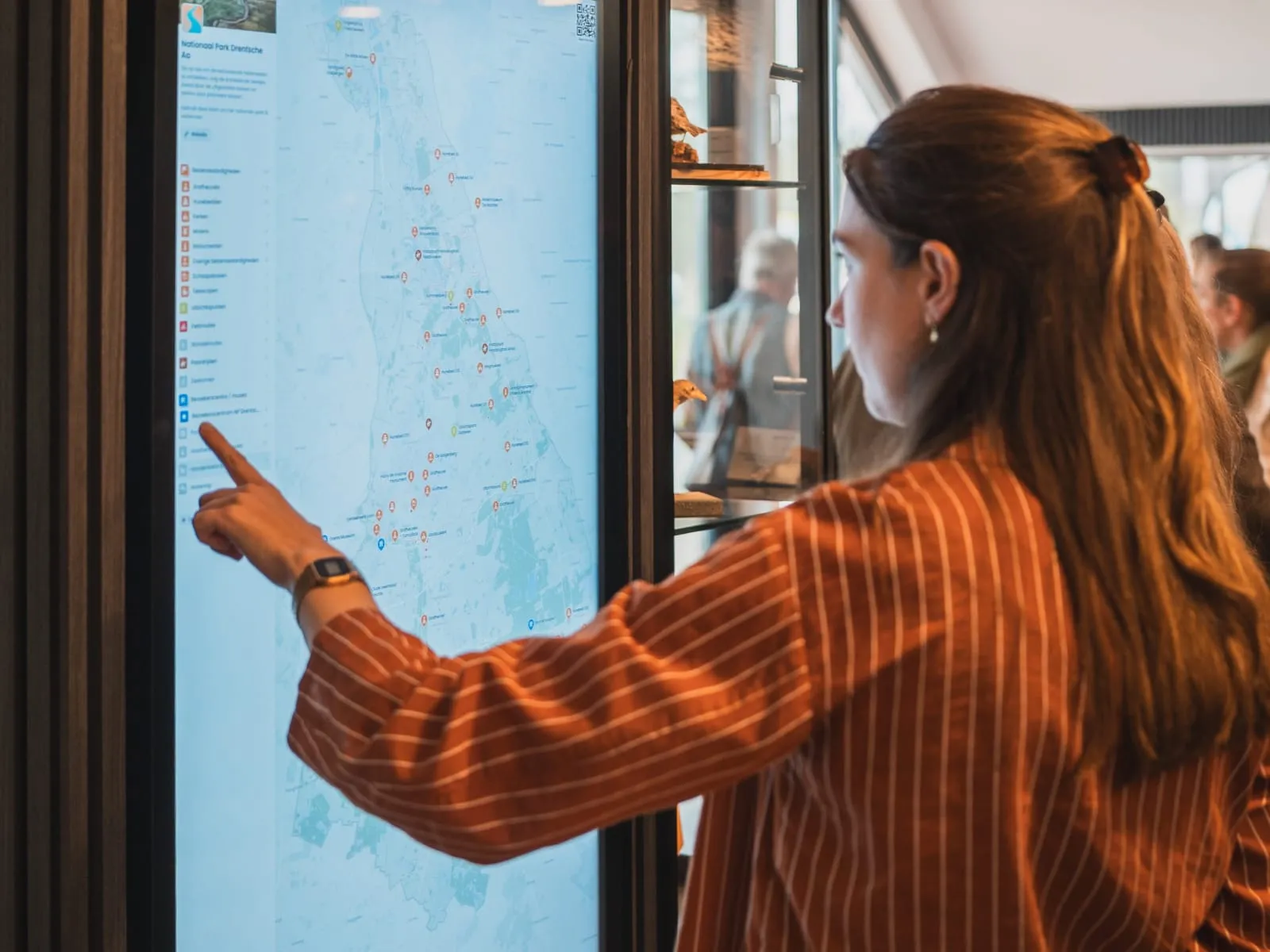
Kiosk
Turn your map into a touchscreen-friendly kiosk for public use in visitor centers, exhibitions, receptions, or shared spaces. That makes it easy for people to browse locations and routes on their own, right where they are, without needing personal guidance first.
Platform & Organization
Suggestions That Keep Your Map Alive
Sometimes your visitors know things before you do. By allowing suggestions, you make it easier to collect new places, timely updates, and valuable local knowledge. That helps your map grow with what is really happening, without everything depending on your team alone.
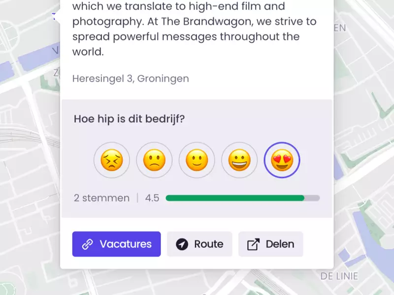
Ratings That Help People Choose
Ratings give you a clearer sense of what stands out and what works well. They help you highlight valuable places, collect feedback, and evaluate new suggestions. That becomes especially useful as your map grows and you want to make better decisions based on real input.
A Map That Fits Your Brand
Your map is often part of something bigger. That is why it should feel connected to your website, your organization, and the style people already know. With your own colors, logo, and imagery, the map feels like a natural extension of your brand instead of a separate tool.
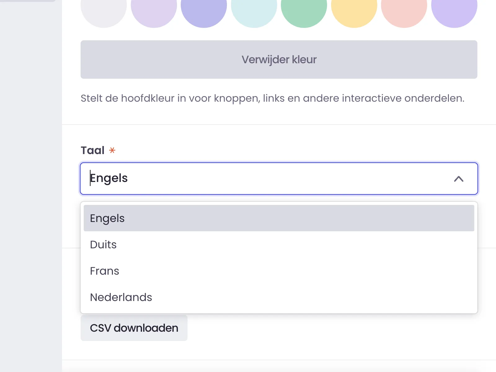
The Right Language for Your Audience
Not every visitor reads the same language, and they should not have to. By setting the right language for your map, you make the experience clearer and more usable for international visitors or multilingual audiences. That makes the map more accessible to more people.
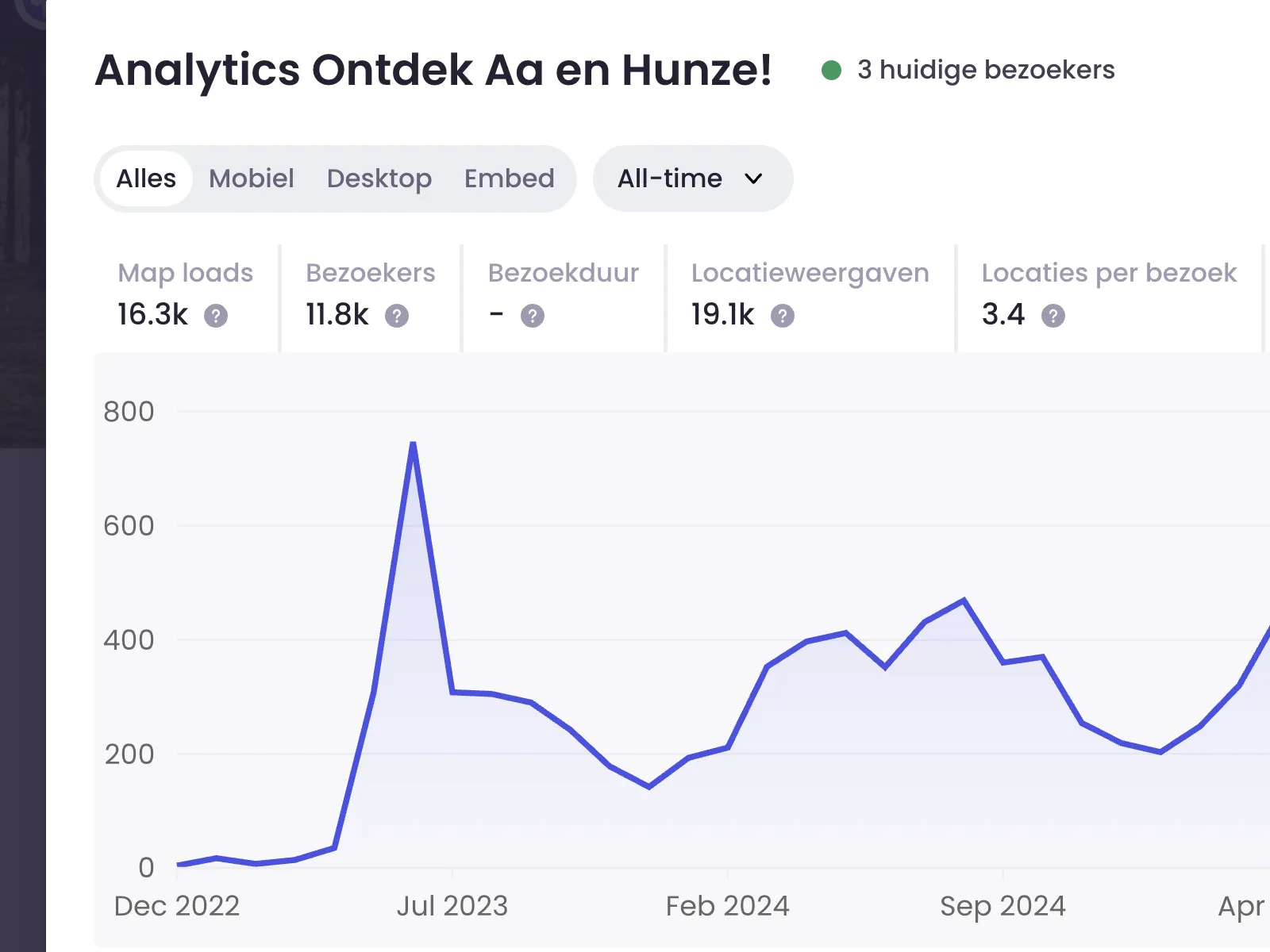
Analytics That Show What Is Actually Happening
Analytics help you see how the map is used in real life. Which places get attention, how often people click, and how many visitors actually use the map? Those insights help you make better choices, with something more solid than intuition alone.
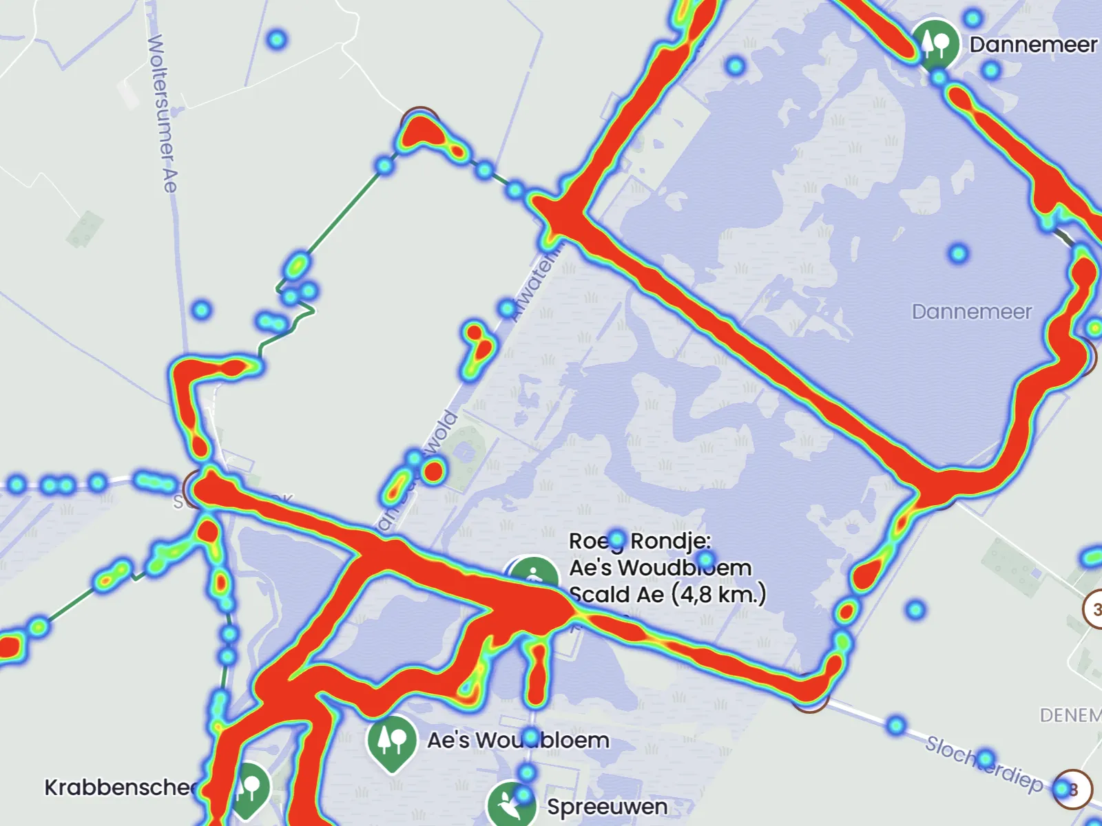
Heatmaps for Understanding Movement
Heatmaps show how visitors move through an area and where attention, traffic, or interest builds up. That helps you spot patterns, understand popular locations, and improve the map based on real behavior instead of assumptions.
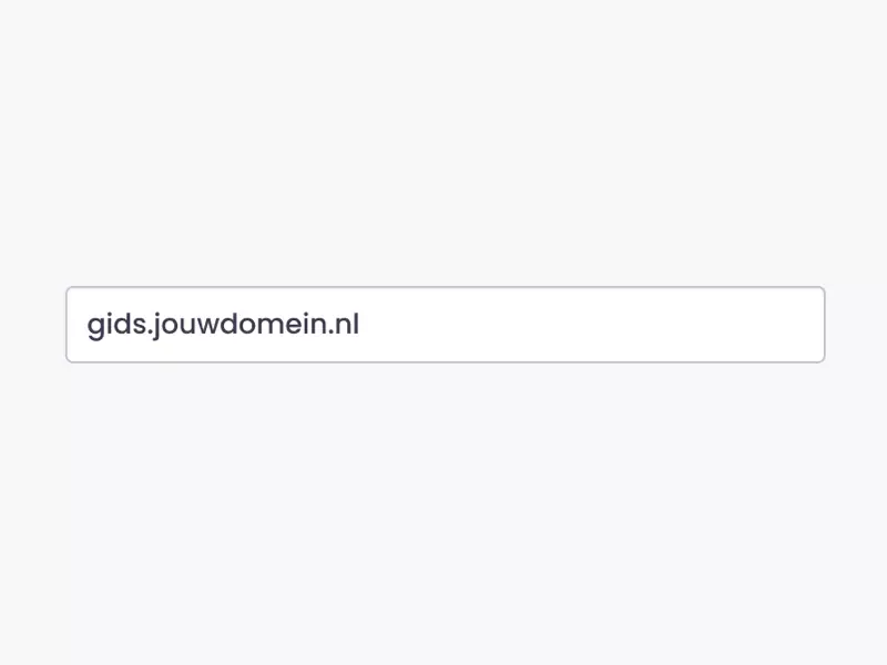
Put Your Map on Your Own Domain
A map on your own domain feels more familiar and more professional. It increases recognition, makes links easier to understand, and helps the map fit naturally with the rest of your website. For visitors, it makes the whole experience feel more consistent.
Accessible to More Visitors
A map should not only work well for most people. It should also be usable for visitors who navigate in different ways. That is why accessibility is not an extra. A WCAG-accessible map helps you reach more people and makes your information more usable for everyone.
Paid maps
Want to make a map available only after a small payment? We do not offer this as a standard feature yet, but it is something we can develop. If this fits your use case, get in touch and we can look at what makes sense.

