

Where
discovery
begins
The platform for interactive maps for your city, region, or nature area. For your visitors, at home and on the go. Your destination. Your brand. Ready to use anywhere.
They make maps with Wolf Maps








Create and manage
interactive maps
An overview map of your area, a city walk, or a themed cycling route: with Wolf Maps, you create and manage different maps from one platform. Decide what to show on each map and use the same map in multiple places.

What Wolf Maps brings to your organization
You want a solution that makes your work easier and fits your organization. With simple management, less printing, insights into usage, and a trusted environment for your visitors.
-
Make your own changes: update places and routes easily. We're here to offer personal support.
-
Your brand comes first: maps in your organization's branding, on your own domain.
-
Less work: up-to-date information helps visitors find their own way. That means fewer questions and less printing.
-
Insights with analytics: see which places and routes are viewed and how your maps are used.
-
Privacy and security: GDPR-compliant and hosted in Europe.
What good maps make possible

Drenthe: municipalities connect their maps into one region

Het Ziltepad: update diversions instantly for walkers

amsterdam&partners: up-to-date maps without duplicate work
Thanks to the digital map of Oerol Festival, the print run is drastically lower and the environmental impact is significantly reduced.
 Carola Poleij Oerol Festival
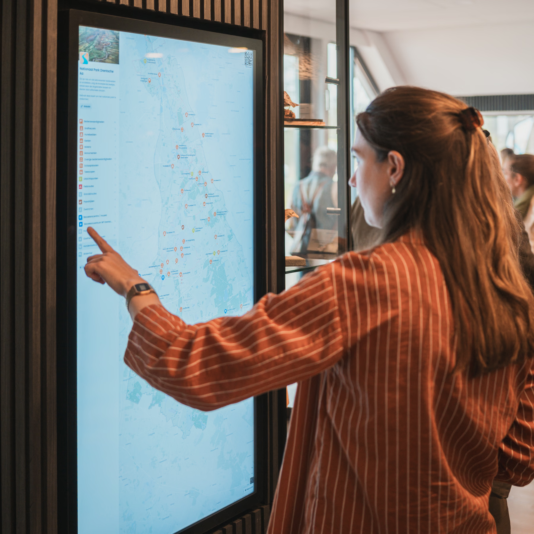
One map for the visitor center, the website, and out in the area. And we manage everything from one place.
 André Brasse National Park Drentsche Aa
So much more user-friendly than a downloadable PDF. And once I start making a map, it is especially hard to stop.
 Gideon Oudshoorn Visit Leeuwarden


You know the best places. We help you share them.
You know what makes your area special. That walk along the water. That little museum. A story you only hear when someone points it out. You want visitors to discover those places and find their way around easily.
But how do you bring it all together? Information is scattered across your website, routes are stored in separate files, and the printed map already needs another update. When what you really want to focus on is what you have to offer your visitors.
We’re Tim and Aljan. We love maps and being outdoors. While working on interactive maps, we noticed how few digital maps invited people to explore. We wanted to do something about that.
That’s why we’re building Wolf Maps. A map that fits your organization, that you can keep up to date yourself, and that visitors can open straight away. Today, organizations including Pieterpad, Waddenvereniging, and Amsterdam & Partners use Wolf Maps to share their world. See what they create with it.
Our promise is simple: we make it easy to create a good map and work with you on your ideas. So you can focus on the places and stories that matter.
Tim and Aljan
Founders of Wolf Maps
Shall we show you around?
In half an hour, we'll show you how Wolf Maps works and discuss your plans. You'll get a sense of the possibilities for your organization and plenty of time to ask questions. No obligation and no preparation required.

